|

|
Equater TM for Windows TM
Database Generation System (DBGS)
|
|
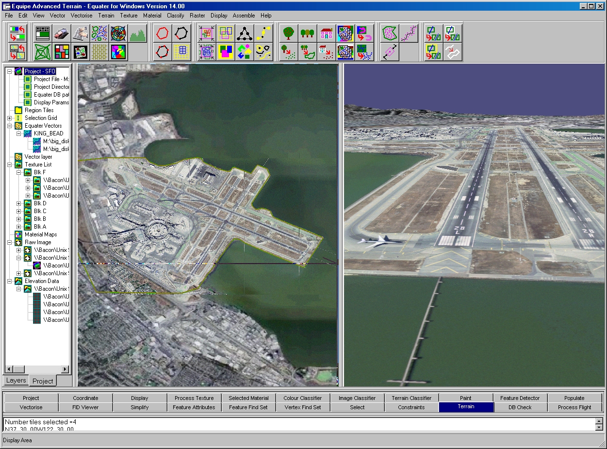
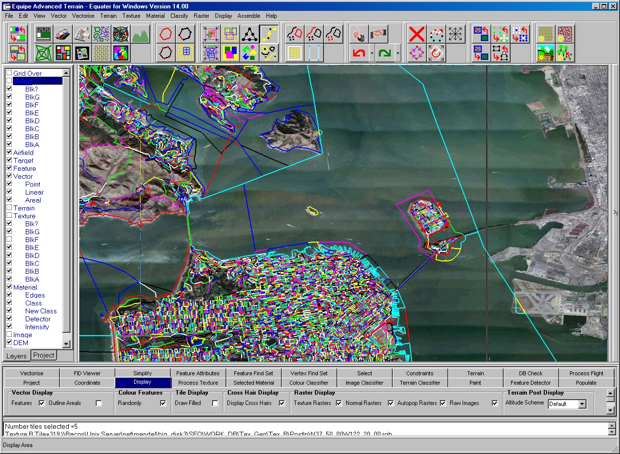
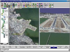
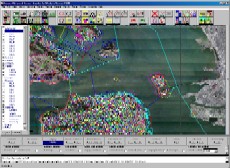
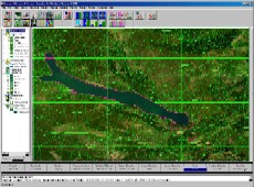
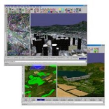
Data Visualisation
2D Geodesic display of following layers :- Terrain DEM, Raw imagery, Material maps, Texture Patterns,
Geometry Tile Boundaries, Terrain mesh, Vector Data, Tile Grid.
Fully Integrated 3D Viewer displays scene without the need to write output files, and allows the user to roam around freely.
Full correlation maintained between 2D and 3D views at all times.
Back to Top
|
| |
Click on image to enlarge
|
|
| |
Click on image to enlarge
|
|
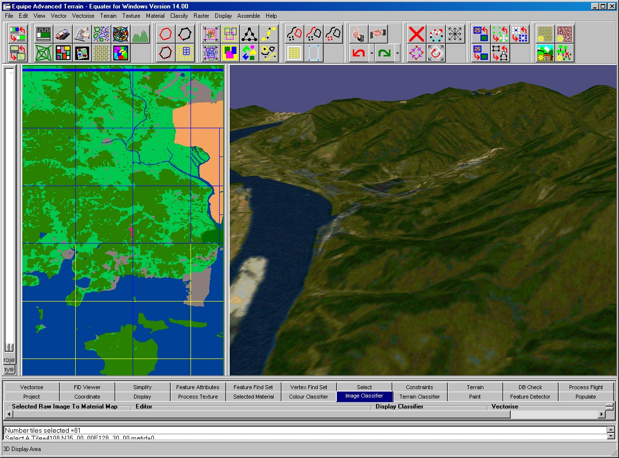
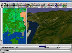
Classification
| Terrain post classification |
- Land, Sea, Shoreline, ridge, valley, plateau |
| Image classification |
- 64 User Definable Area classifications. Edge classifications |
| Material Pixel classification |
- 256 classifications |
Back to Top
|
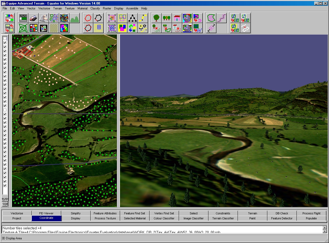
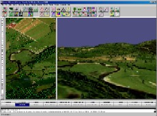
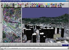
Auto Population
Image detection of Point ( Individual Trees, Buildings... ), Area ( Forests, Lakes, Towns... ) and Linear features ( Roads, Rivers, Railways... ) in Satellite and Aerial Imagery.
Realistic placement of features with imagery.
Detector Parameters determine the density, number and size of features detected.
Raster to Vector conversion - Area features can be shrunk so forests sit inside their image.
Models selected and scaled appropriately to type and size of detected feature.
Batch processing - Large areas can be selected and rapidly populated.
Back to Top
|
| |
Click on image to enlarge
|
|
| |
Click on image to enlarge
|
|
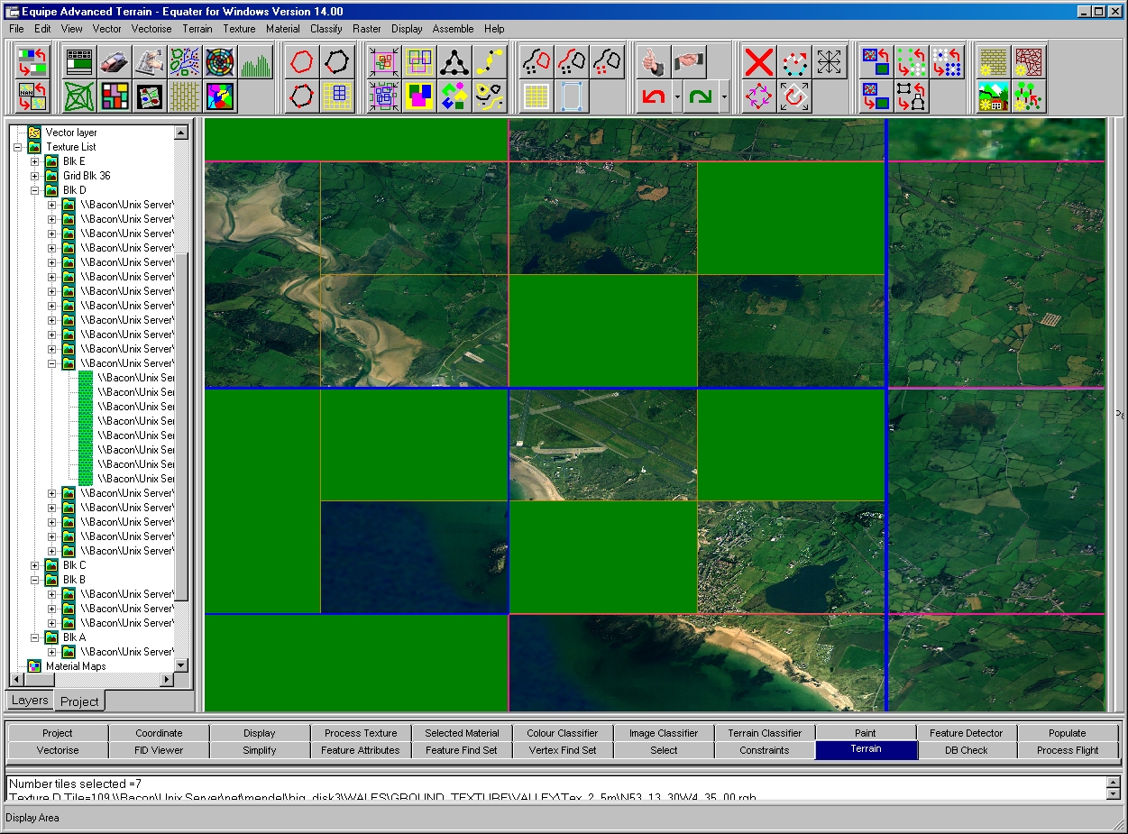
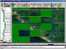
Texture Processing
Process texture batch processing
Texture Pattern generation
Cut out - from large mosaic satellite or aerial imagery.
Colourise - Colouring Black and White imagery.
Altitude texture - rendering texture assigned to altitude layers.
Material Raster Paint - rendering textures assigned to material maps.
Pre and Post image processing :- Gamma, contrast, brightness, saturate, user defined.
Texture Merge :- for removal of edge of image artifacts or resolution merging
Vector paint :- cultural features roads, rivers, towns etc.
Manual Mouse driven Paint box
Painting of Terrain, Material and Texture rasters across multiple tiles and boundaries.
Back to Top
|
Vector Processing
Classified Raster to Vector conversion - Terrain class, Material class, Edge class
OpenFlight to Vector conversion - Automatic creation of complex hulls form OpenFlight models.
Material feature cloning - Material textures populated once and features then cloned where ever material used.
Point feature populator - Inside area or along selected edges.
Geometry Editing - Create Area, Linear Point, Add vertex, Delete, Translate, Reverse, Combine. Vector clipping - Cut vectors against each other ( e.g. rivers through tree blocks )
Vector simplification - Features or vertices "Commented out" of processing can be put back in at latter stages. Feature simplification by FID code, feature density, range simplification. Shrink wrap Vertex simplification based on :- Max Error, Percentage, Number of vertices.
Curve generation tool
Point feature footprint editor - Translate, rotate, scale footprint
Vector Attribute Editing - Feature Attribute editor, FID Viewer, Find and Set attributes - With support for range and arithmetic functions.
Vector validation - Geometry and attribute checking.
Back to Top
|
| |
Click on image to enlarge
|
|
| |
Click on image to enlarge
|
|
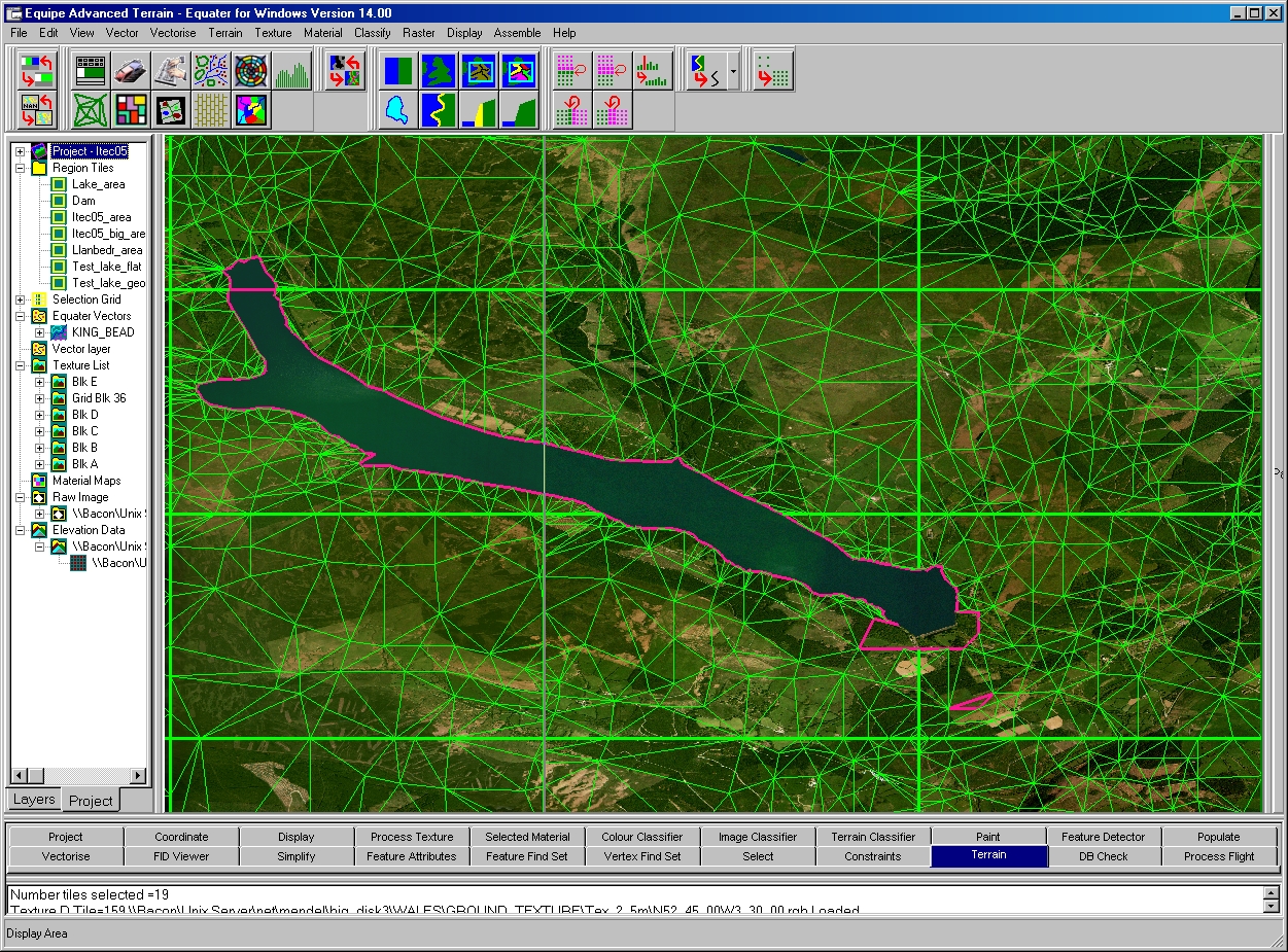
Terrain Skin Preparation
Terrain raster Validation - Boundary mismatch error detection. Unusual spike / dip detection and correction. Manuscript border post matching.
Regular or irregular terrain Mesh. Up to 5 Levels of detail per tile. Complexity restricted by number polygons or fit tolerance. Preview terrain mesh generation for parameter determination and constraint testing.
Constrained terrain Mesh - Area, edge or vertex constraints. Inhibit terrain, Remove Terrain.
Coast line pinning
Back to Top
|
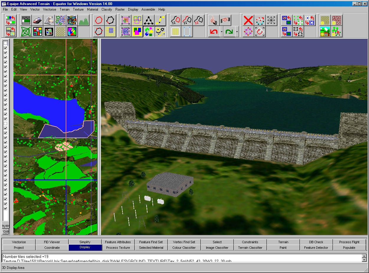
Database Assembly
Pre Assembly Checks - Geometry and attribute checking
Terrain and Feature Polygonisation - Support for Multiple LOD, Structure and file size.
Automatic assignment of ground texture
Configurable Feature Polygonisation -
Area
Side and top textures can be defined
Flat textured polygons
Raised textured sizes for tree blocks or buildings
Raised area tops
Linear
Extrusion nozzle models can be used to define linear cross sections
Strung linear features - Pylons telegraph wires etc
Point
Random selection of different models
OpenFlight models from model library incorporated
Support for external models
Output projections
Flat Earth
Localized Flat Earth ( Local origin at centre of tile )
Localized Geocentric ( Local origin at centre of tile )
OpenFlight Output
Output database structured and LOD control.
Large Area Batch processing of Texture, Terrain, Features
Back to Top
|
| |
Click on image to enlarge
|
|
| |
Click on image to enlarge
|
|
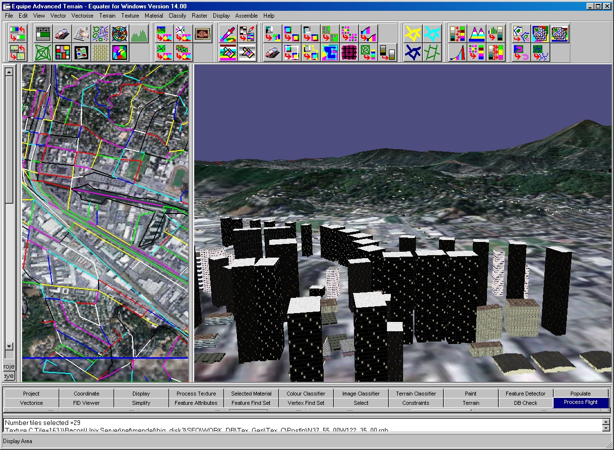
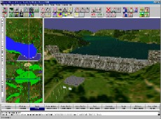
Viewing Assembled Database
FLY button - displays a 3D viewer which can be used to view selected assembled terrain and feature files allowing quick reviews of the output database. 3D viewer linked to 2D viewer.
IG button -Can be configured to invoke a user defined IG invoked from the command line.
BlueSky button - automatically compiles and generates all BlueSky textures, flight and configuration files.
Back to Top
|
Data Import/Export
|
Import |
Export |
| Imagery |
SGI, TIFF, JPEG, etc. |
SGI, BlueSky |
| DEM |
DTED, Equater Terrain Raster |
Equater Terrain Raster |
| Vector |
DFAD, ESRI Shape files, Equater Vector |
Equater vector |
| Projections |
Geographic, Mercator |
N/A |
| Polygon |
N/A |
OpenFlight, BlueSky |
| Customer specific |
( Please ask ) |
( Please ask ) |
Back to Top
|
Support
Hardware / Software platforms - PC ( Windows 2000, XP & Vista)
Recommended PC specification : 3.0Ghz processor. 1Gbyte RAM. 120Gbyte Disk. 128MB OpenGL graphics card. 1280X1024 screen resolution. Network adapter card.
Documentation and Training - Comprehensive user guide and step by step tutorials. In-house and on-site training for all aspects of the Equipe modeling process can be provided.
Support for specific input and output formats - Equipe can provide support for customer unique formats and requirements.
Back to Top
|
|

|
|
C-series
Cross-Cockpit Collimated displays
|

|
|
|
Generation 10
COTS multi-channel IG with added value and ultra high performance
|

|
|
|
BlueSky
Complete System Integration with BlueSky Visual Real-Time Software
|

|
|
|
ProMap
Enables Projection onto curved screens with mapping, blending and shading
|

|
|
|
Equater
Equater enables large area Geo-specific terrain models to be created in hours
|
|
|
|
Global Projector
Our target projector provides a cost-effective target entity at near eye-limiting resolution
|

|
|
|

 Home
Contact Us
Careers
Copyright © 2018 Equipe Electronics Ltd
Home
Contact Us
Careers
Copyright © 2018 Equipe Electronics Ltd